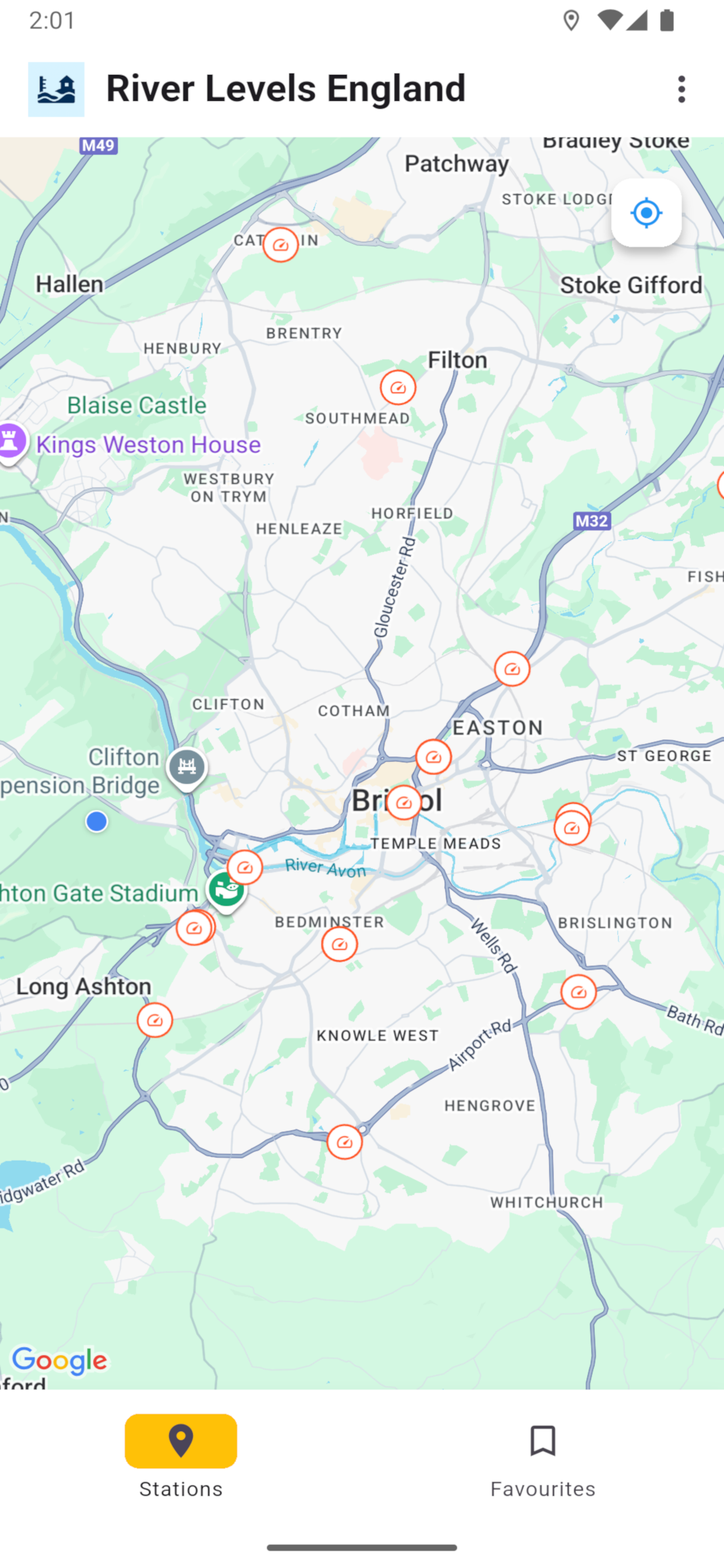
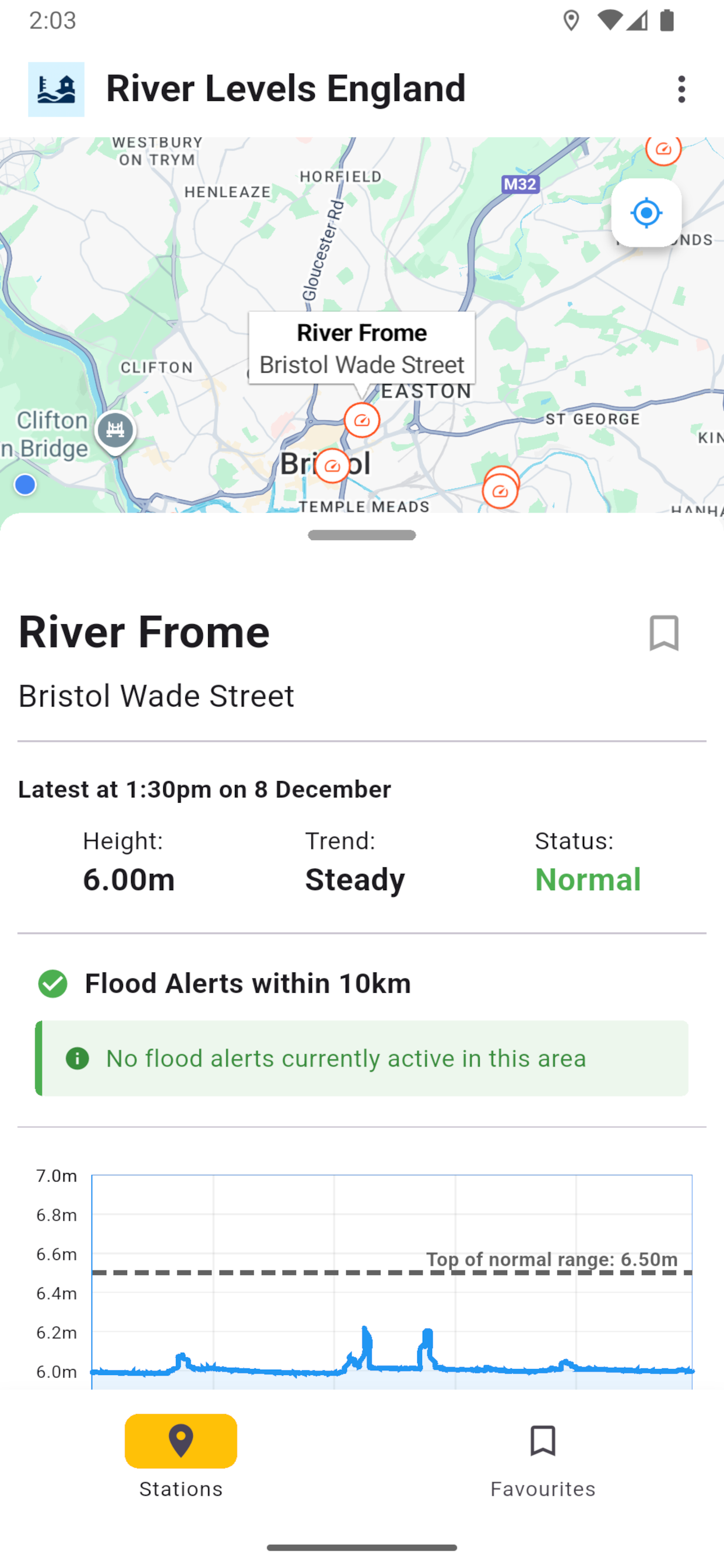
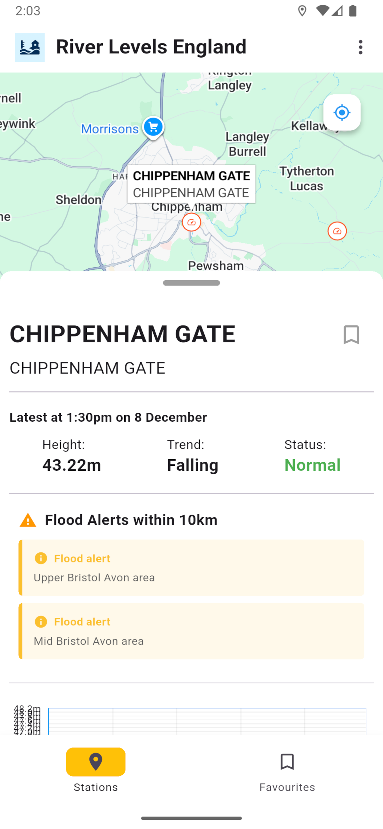
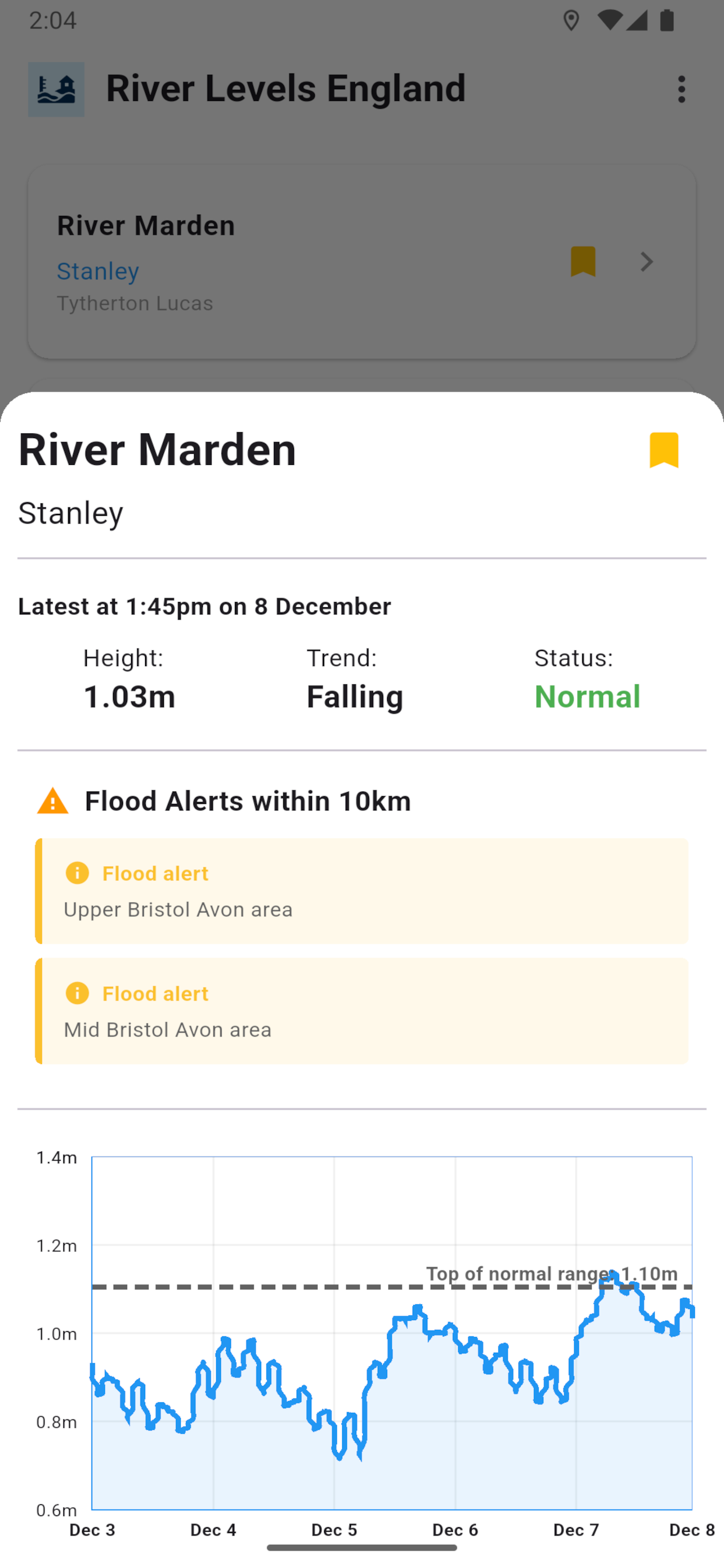
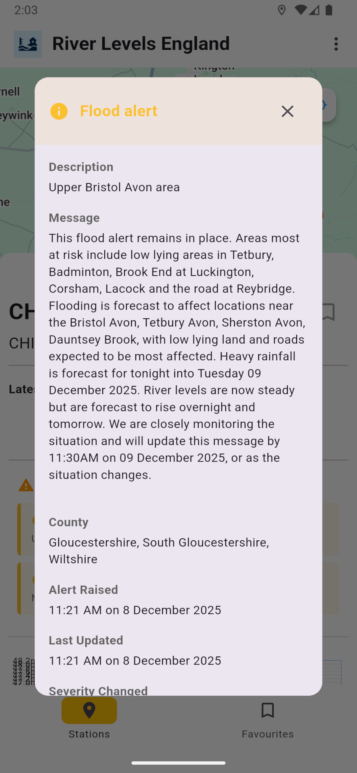
I finally had the time to recently finish a side-project I’ve been working on. My flutter app, River Levels England, uses the Environment Agency’s data api along with Google Maps and a charting library to present near-live river level and flood alert data in an accessible way.
EA data is updated every 15 minutes so I make use of local cacheing to avoid unnecessary api calls.
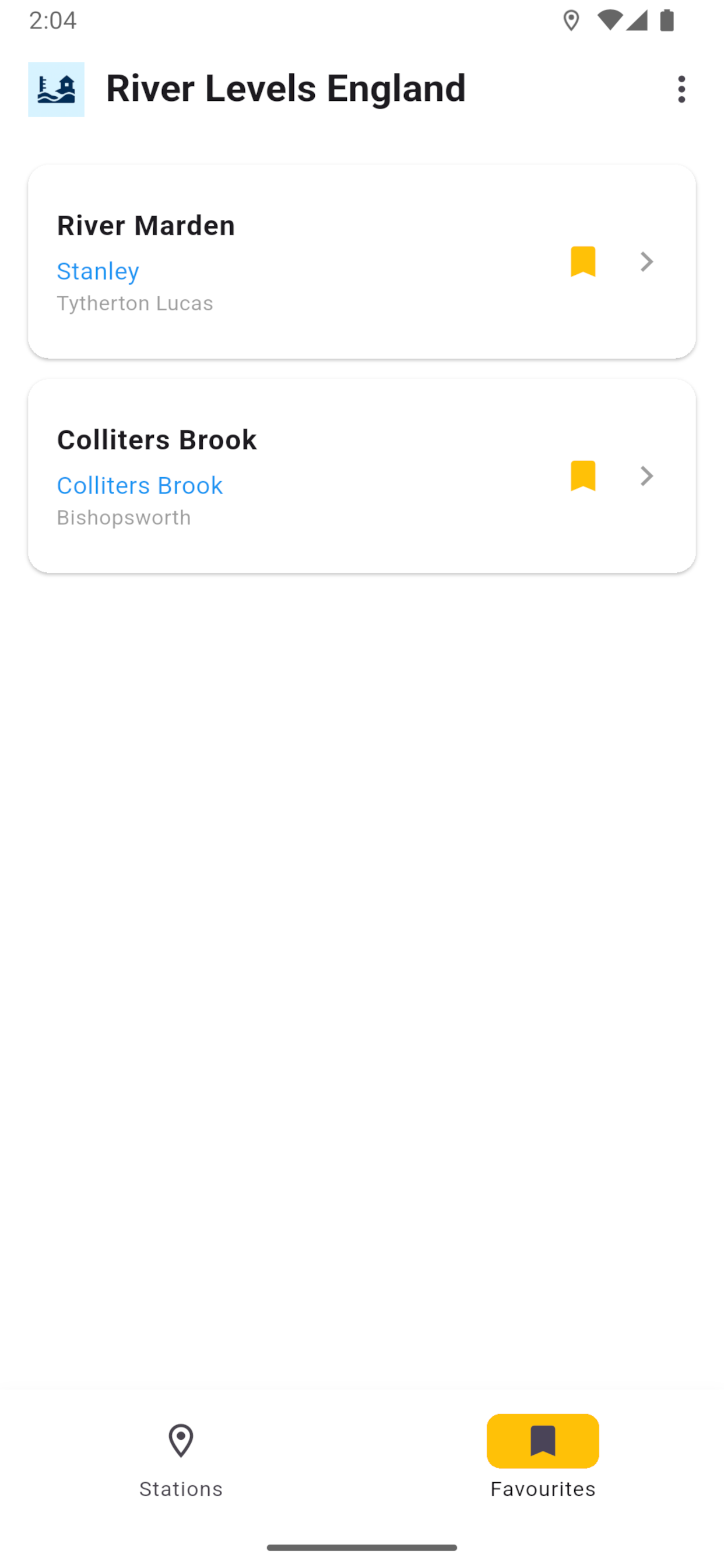
Users can view current river level, current trend (rising/falling) and recent historical data. They can also favorite their river level stations of interest.
In the future I may look into Scotland & Wales (I’ve no idea if this dasta is available), and perhaps add tide data too.
You can download the app here: